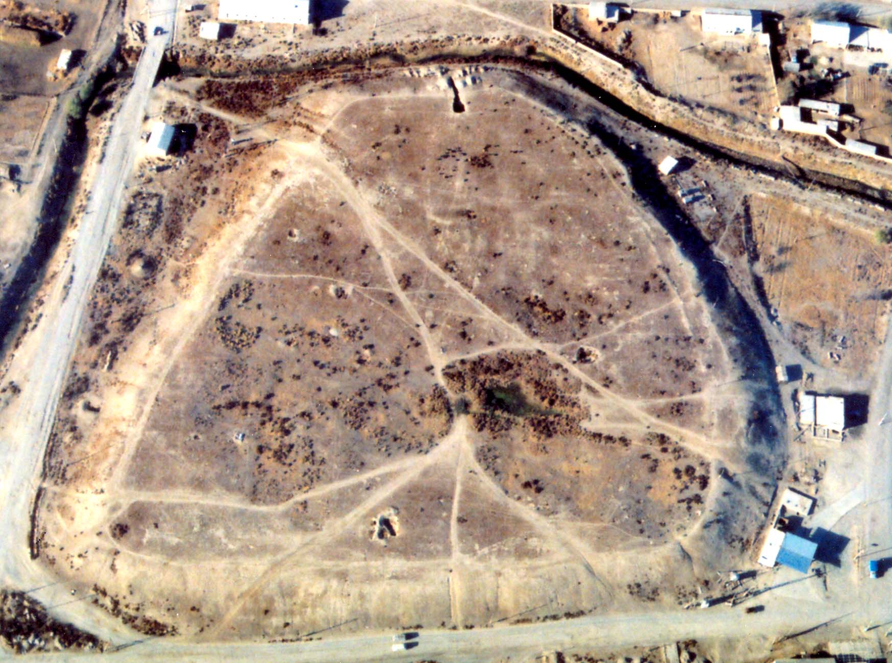
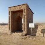
Located 24 km southeast of the city of Turkestan, in the central part of the village of Yeski Ikan, covers the Х-ХV – XVIII centuries. In the XVIII century, the city of Ikan gained popularity due to the fact that it was the headquarters of Tursyn Khan (1712-1717) and his son Barak (1749-1750). We do not have accurate data on when Ikan was built, which now became a hill. In his work «Abdullanam» Hafiz Tynysh writes that the Bukhara Khan Abdullah in 1582, during a campaign against the Tashkent ruler, the Bab Sultan, stopped at Ikan. The famous historian P. I. Rychkov, who lived in ХVІІІ century, in his work «Topography of the Orenburg Province» in the 18th century, indicated that there were about 300 houses in Ikan and its inhabitants were engaged in agriculture. In the Middle Ages, Ikan played a significant role among the cities of the Turkestan Territory. Currently, the preserved place of the hill is trapezoidal, 6-7 meters high and 300-225 meters in volume. /In the southeastern part, the remains of the citadel are displayed, as well as the outlines of various buildings in structure. According to the layout, it can be assumed that the gates of the city were in the northwest with several towers, and thus they observed and guarded the city. Most of the city was destroyed during the construction of new facilities. In the monograph by E.I. Ageeva and G.I. Patsevich in 1951, there is a plan and a topographical survey of the settlement before its destruction. The plan contains the remains of the citadel on the southeast side of the hill. Currently, the size of the hill on the north side is 200m, southwest-210m, southeast-240m, northwest-85m. The total area of the hill is 4.6 hectares. In 1947, it was investigated by the South Kazakhstan Archaeological Expedition (S.N. Bernshtam). In 1999, the Turkestan archaeological expedition examined it for the second time (M.K. Tuyakbaev). Three exploratory excavations were launched in Shakharistan, two exploratory excavations were launched into the citadel. The first of the excavations in the citadel consists of 3 building tiers, 2.5 x 2 m in size, the second consists of 6 building tiers, 4.5 x 2 m in size. However, the pits were not opened further from the level of the 9th century, as the lower floors, due to the incessant drainage well, turned into a kind of muddy water. In 1994, it was entered into the collection of «Annals of historical and cultural monuments of Kazakhstan» in the South Kazakhstan region under number 631, and was taken under state protection. The total land area is 4.7 hectares.
Hillfort Ikan
-
Administration
- 29 May 2020
- Arheological monuments
- 867