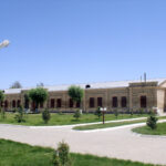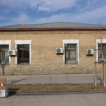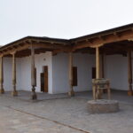
The The mosque of Bab Arab is located 620 meters from the Mausoleum of Khoja Ahmed Yasawi. Coordinates: 43.2966337, 068.2622416. The Bab Arab Mausoleum and Mosque were restored based on historical data collected during theodolite…
Read More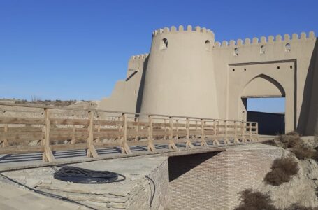
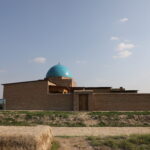
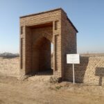
The bridge was located outside of the Zheti Ata gate. Coordinates: 43.2965984, 068.2617400. The gate “Zheti Ata” called “Zheti Ata Mausoleum” means seven ancestors, due a single tomb located outside the city wall where buried…
Read More
The fortress structure surrounding Old Turkestan was built in the first half of the 19th century. Coordinates: 43˚17.949΄, 068˚16.490΄. Historical sources indicated that the ancient city consisted of three parts: the Citadel, the Shahristan, and…
Read More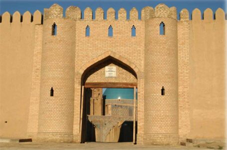
The gate was at northeastern wall of the citadel and consisted of a double-leaf wooden door. Coordinates: 43˚17.912΄, 068˚16.376΄. The gate doors were decorated with ornamental carvings, and on both sides located towers. Spiral staircases…
Read More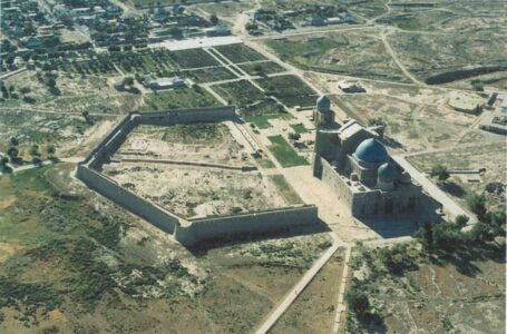
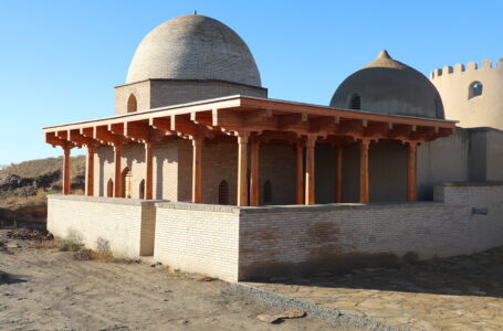
A fortification-type monument located on the eastern side of the Mausoleum of Khoja Ahmed Yasawi. It is a monument of national significance. Coordinates: 43˚17.894΄, 068˚16.262. In the earliest schematic plan of Turkistan’s fortifications, created in…
Read More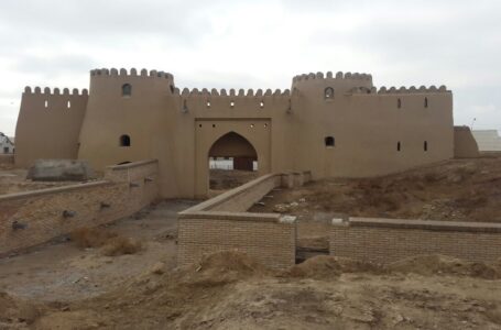
Around the Mausoleum of Khoja Ahmed Yasawi within the territory of the shahristan of Old Turkistan — there were four gates. For this reason, historical sources referred to the city as the“Four-Gated Turkistan”. One of…
Read More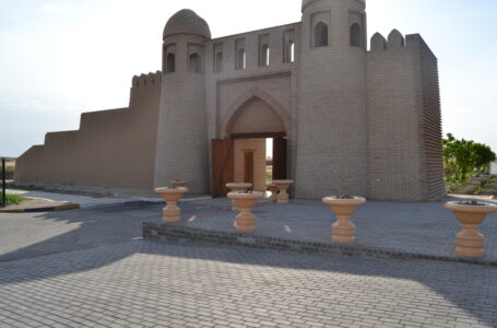
The gate Musalla is located 150 meters in front of the Mausoleum of Khoja Ahmed Yasawi. Coordinates: 43˚17.751΄, 068˚16.409΄. Within the “Cultural Heritage” program, in Old Turkistan were identified a number of sites due for…
Read More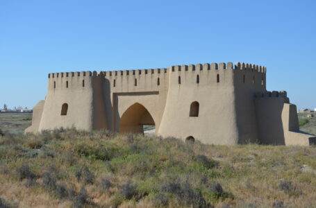
The gate Takia is located 800 m from the mausoleum of Khoja Ahmed Yasawi. Coordinates: 43.2928147, 068.2660778. These gates, called “Takiya” or “Ishan”, are marked on a map of 1864, which indicates that they were…
Read More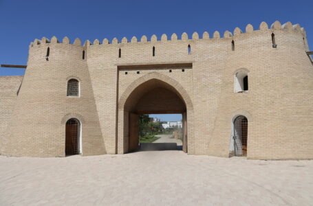
The gate Darbaza located 400 meters northwest of the Mausoleum of Khoja Ahmed Yasawi. Coordinates: 43.3005884, 068.2690768. It is one of the four historical gates of Turkistan. The gate was restored based on a lithographic…
Read More
A MEMORANDUM OF COOPERATION SIGNED BETWEEN THE “AZIRET SULTAN” NATIONAL HISTORICAL AND CULTURAL MUSEUM-RESERVE AND THE INTERNATIONAL EDUCATIONAL CORPORATION Today, a Memorandum of Cooperation was signed between the “Aziret Sultan” National Historical and Cultural Museum-Reserve…
Read More
Address: Turkistan city, Aiteke bi 1B
Tel./fax: 8 (72533) 3-23-00, E-mail: azret-sultan@mail.ru
Operation mode: 09:00-18:00