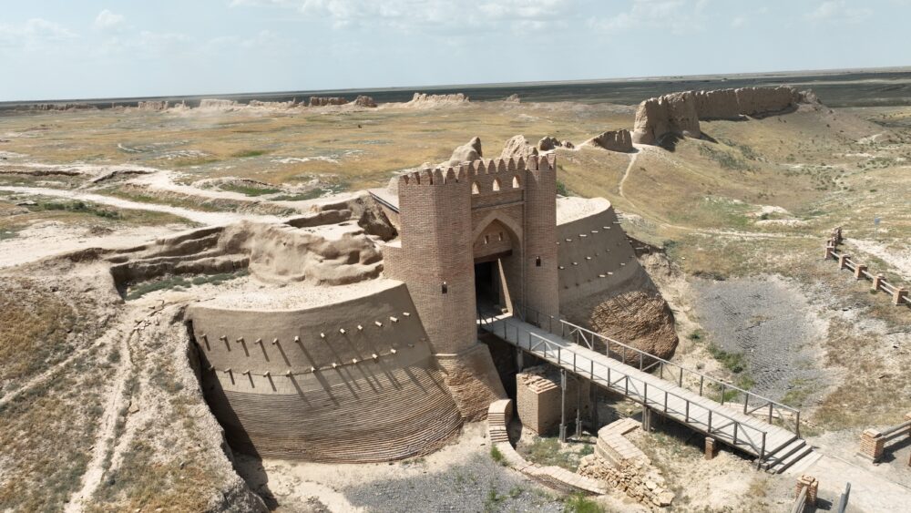
The site of Sauran is located 44 km northwest of the city of Turkistan. It is a monument of republican significance. Coordinates: 43˚31.106΄, 067˚46.337΄. The late medieval city of Sauran represents a direct continuation of the earlier medieval city of Karatobe-Sauran (4th–14th centuries), which lay 3 km southeast of the present-day site. The first written references of Sauran date to the first half of the 10th century. The city is mentioned by al-Istakhri in his “Book of Roads and Kingdoms” and by al-Muqaddasi. Information about it is also found in the writings of the Arab geographer Ibn Hawqal (976), the anonymous geographical treatise “Hudud al-‘Alam” (10th c.), and in the 13th century in the works of Armenian King Hetum I, historian Ibn al-Athir, and in the encyclopedic dictionary “Dictionary of Countries” by Yaqut al-Hamawi. These early references primarily concern Karatobe-Sauran (4th–14th centuries). In the 15th–16th centuries, the number of written mentions of Sauran significantly increased. The city appears in the works of Mu‘in ad-din Natanzi “Anonymous of Iskandar”, (early 15th c.), “Tavarikh-i guzida-yi nusrat-name”, Molla Shadi “Fath-name”, Kamal ad-din Bina’i “Shaybani-name”, Ruzbihan Isfahani “Mihman-name-yi Bukhara”, (16th c.), Zayn ad-din Wasifi “Bidayat al-waqa’i”, and Hafiz Tanish “Sharaf-name-yi shahi”. Russian sources mentioning Sauran begin from the 17th century. According to medieval written accounts, in the 10th century seven fortress walls surrounded Sauran and its rabad was located within the city fortifications. Originally, Sauran was an Oghuz frontier fortress against the Kipchaks. In the early 13th century, it is mentioned as a frontier city, alongside Isfijab, exempt from paying kharaj (tax). By the mid-13th century, Sauran was described as a large city, and in the 14th century it is listed as one of the towns of the White Horde (sometimes referred to as its capital). In the works of 15th–16th century authors, Sauran often appears in the context of the struggle between the Kazakh Khanate and the Shaybanid state for dominance in the Turkistan region. Currently, the late medieval city of Sauran is enclosed by fortress walls stretching 850 m north to south and 660 m east to west. In some areas, the preserved sections of the walls reach 3–6 m in height. Entry into the city was possible through two main gates, located on the northern and southern sides. Seven defensive towers were built at the fortress corners and by the city gates. The total length of the walls is about 2,360 m. They were constructed of mudbrick and rammed earth atop a 2–3-meter earthen stylobate. The tallest tower, located in the northeastern corner of the fortress, reached a height of 6 m.
From the outside, the fortress was surrounded by a deep moat measuring 4–5 m in depth and 15–20 m in width. The decline of Sauran began in the 1680s, similar to other cities of the Syr Darya middle reaches. By the mid-18th century, P. I. Rychkov described Sauran as a “small settlement near Turkistan.” In the first half of the 19th century, the city ceased to exist altogether.
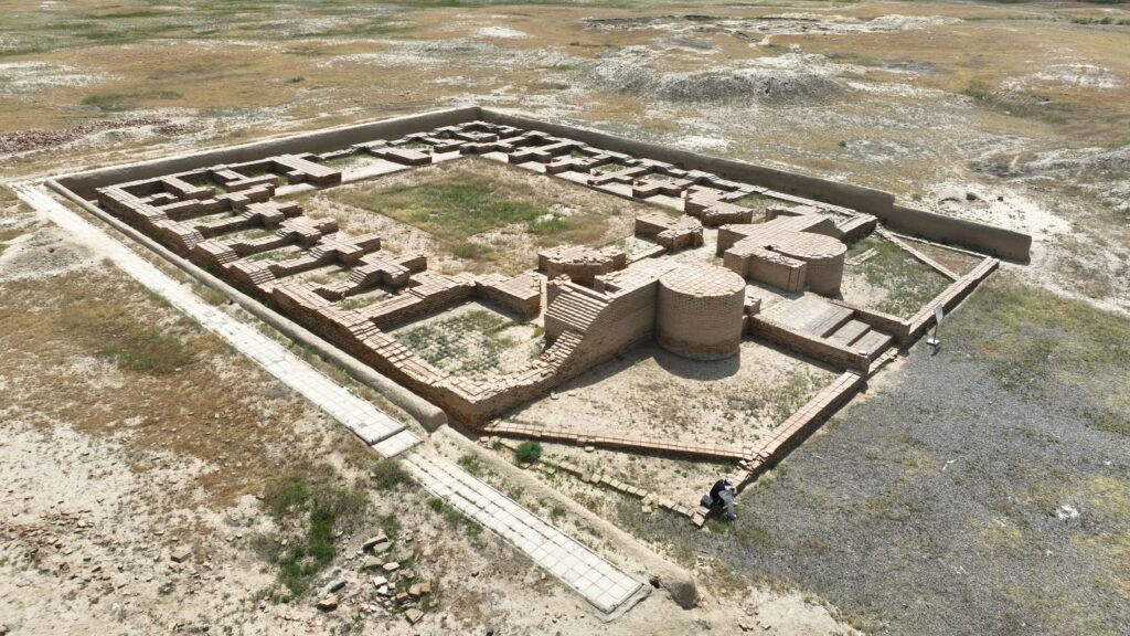
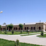
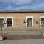
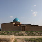
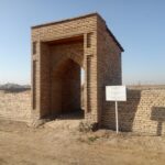
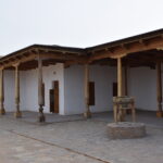
The study of the site of Sauran began in 1867, when it was surveyed by I. P. Lerch. Later, the monument was investigated by various archaeological expeditions several times: in 1947 by the South Kazakhstan Archaeological Expedition (A. N. Bernshtam); in 1967 by the Zhetysu Archaeological Expedition (K. A. Akishev); in 1986 by the expedition of the Historical and Cultural Monuments, Institute of History, Archaeology and Ethnography named after Sh. Sh. Ualikhanov. From 1998 to 2014, the Turkistan Archaeological Expedition (E. A. Smagulov, M. K. Tuyakbayev) conducted research. Between 2005 and 2009, the Center for Archaeology of Khoja Ahmed Yasawi University (M. Eleuov), the Institute of Archaeology named after A. Margulan (K. M. Baipakov), and specialists of the Otrar State Archaeological Museum-Reserve (N. Aldabergenov) carried out work alternately. As a result of the excavations, were uncovered important elements of the city layout and conserved, the main square in the central part of the city and the Sauran madrasah located in the southeast (15th–16th c.); the Khanaka in the northwest (15th–16th c.), where lived and studied Sufi communities; the central mosque (15th c.) situated west of the Khanaka. In addition, the northern city gates were excavated and restored, along with the main street leading from the gates to the central square (172 m long), the moat and bridge in front of the gates, as well as one of the fortress’s defensive towers.