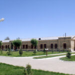
The fortress structure surrounding Old Turkestan was built in the first half of the 19th century. Coordinates: 43˚17.949΄, 068˚16.490΄. Historical sources indicated that the ancient city consisted of three parts: the Citadel, the Shahristan, and the Rabad. These data were also confirmed by the results of archaeological excavations. Currently due to avoid close the panoramic view of the Mausoleum of Khoja Ahmed Yasawi and the surrounding historical and cultural monuments, have been restored only the foundations of the fortress walls. The base of the Shahristan wall now appears as a boundary between the modern city and medieval Turkestan. The history of Turkestan shows that the formation and development of the city passed in three stages: The first stage — the period of the city of Yasy–Kultobe. At that time, the area of the Shahristan was 2 hectares, and the Citadel — only 0.6 hectares. The city with the a teritory of Rabat occupied about 10 hectares. It began to form in the 3rd century BCE and reached this level by the end of the 14th century (see Map 1).
The second stage — from the late 14th century (after the reconstruction of the Mausoleum) to the end of the 18th century. During this period, the area of the city reached 36 hectares: the Citadels occupied 4 and 1.3 hectares (there were two of them, see Map 4), and the remaining territory belonged to the Shahristan (32 hectares, Map 2). On the northwestern side of the Shahristan there were three gates, on the southeastern side — another three, and in the Citadel — one gate on each, the northeast and southwest sides. The Rabad was very extensive.
The third stage — all new territories became part of the Yasy–Turkestan of the second period. The length of the city fortress wall during the second stage was about 2 km; during the first stage (Yasy–Kultobe) — about 600 m; and during the third stage (Old Turkestan) — 3.5 km (on the map, marked with a blue line, No. 3). On the map, the boundaries of Yasy–Kultobe are indicated with a black line, the Yasy–Turkestan with a red-brown line, and the Old Turkestan by a blue line (Fig. 1). The territory of the Shahristan reached up to 88.2 hectares.
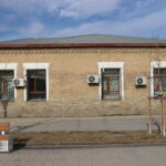
Regarding the towers located along the fortress walls and on both sides of the gates: the towers of Yasy–Kultobe have not survived, and their number is unknown. However, for defensive purposes, it was considered necessary to build towers every 100 steps (about 80 m). The effective range of a bow was 40–50 m; therefore, towers were constructed every 80–100 m. (This method was used only in fortresses with thin walls, along which it was impossible to walk, and shooting could be conducted only from the towers.) In cases when the thickness of the fortress walls reached 2–4 m and allowed fighting from their upper part (shooting with bows, throwing spears, and using pikes or slings), the distance between towers could increase to 100–200 m, and sometimes up to 280 m (Fig. 2). Along the fortress wall of Old Turkestan there were 11 towers; if we add the double towers of the four gates, the total number reached 19. The Citadel had 9 towers — all of them were built by the Kokandians between 1843 and 1849. In the 18th century, the city had 9 gates, six of which had double towers, giving a total of 12 towers. During the last two periods, the fortress on the outside was surrounded by a water-filled moat 6–7 m deep and up to 10 m wide. Water flowed into it through the “Tastak”, “Baulyk” and “Darbaza” canals.
Литература:
- Туякбаев М. Ясы-Культобе. Ески Туркестан // Историческая топография и развитие городов и поселений Туркестанского оазиса (XIII-XIXвв.) А.,2009. С.69-75; 76-102, 154-157; 158-178.
- Смағұлов Е., Тұяқбаев М. Түркістанның ортағасырлық тарихы. Түр.,1998. 51бет.