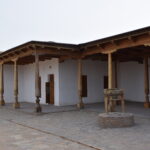
The Khan’s Orda (the khan’s residence and court) was located about 300 meters west of the Mausoleum of Khoja Ahmed Yasawi. Coordinates: 43˚17.847΄, 068˚15.966΄. Historical sources indicate that in the 18th century, there were two khan’s residences (citadels) in Old Turkestan. Detailed information on this is provided in I.V. Yerofeyeva’s study “Kazakh Khans and Khan Dynasties in the 18th – mid-19th centuries” and in the work of B.T. Tuyakbayev and A.N. Proskurin “Project of the Citadel Regeneration in the City of Turkistan.”
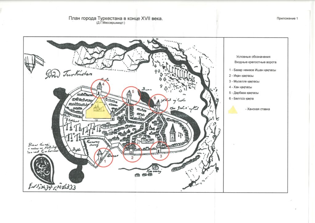
According to historian I.V. Yerofeyeva, in 1743–1745 Turkistan and its surrounding towns were divided into two parts and governed by Khan Abilmambet and Seit, the eldest son of Sameke Khan. The first mention of this appears on a map by D.G. Messerschmidt, compiled at the end of the 17th century. By comparing the1875, the 1954 maps of the city, and later schematic plans, researchers were able to identify the exact location of the khan’s orda. Archaeological excavations revealed that the sixth construction layer at this site was formed between the late 17th and the first half of the 18th century, corresponding to the period when Tauke Khan, Kaiyp Khan, Bolat Khan, Sameke Khan, and Abilmambet Khan resided here.
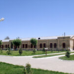
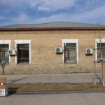
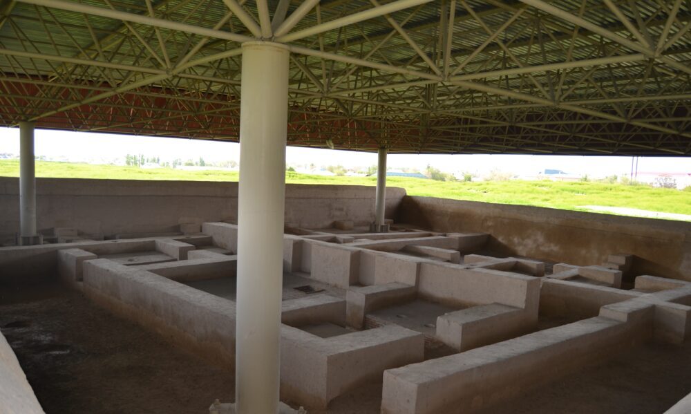
In 1743–1745, Seit, the eldest son of Sameke Khan, established a second orda east of the Mausoleum of Khoja Ahmed Yasawi. After the death of Abilmambet Khan (1771), the first orda apparently passed to his son Bolat Khan, who lived there until 1798. During the 2011 archaeological excavations, 15 rooms of the orda were uncovered, their walls rebuilt with adobe bricks. Depending on their degree of preservation, the walls were restored to a height of 1.2–2 meters. Inside the rooms, reconstructions were made of “sypa” (platform beds), “tandyrs” (ovens), “tashnaus” (drainage channels), and “sandals” (low braziers used for heating). The walls were coated with a special clay-and-straw plaster, which helped to recreate part of the khan’s residence and convey its historical appearance.
Between 2012 and 2022, the Turkistan Archaeological Expedition together with the Archaeology Institute of the International Kazakh-Turkish University named after Khoja Ahmed Yasawi carried out excavations in the southeastern part of the Khans court, where were identified structures dating to the reign of Tauke Khan (1680–1715). The company “Kazkaitazhangyrtu” conserved and covered these remains. During these years, the buildings from the time of Abilmambet Khan and Tauke Khan were fully uncovered up to the Eastern and Northern streets, and further structures were investigated and preserved up to the Central Street. The court, surrounded on all four sides by streets and fortress walls, occupied a total area of 1.32 hectares. 110 meters of this, the “Zheti Ata” street belonged to the territory of Khans court; the length of the Eastern Street was 82 m, the Northern – 100 m, the Western – 120 m, and the street dividing the khans court into two parts – 110 m. In total, 522 meters of street layout were uncovered. The total area of buildings belonging to the Khans court amounted to 928.972 sq. m.
The foundation of the Khans court dates back to the reign of Yesim Khan (1598–1628). Later it was used as the residence of Zhanibek Khan (1629–1646), Zhangir Khan (1646–1652), Tauke Khan (1680–1715), Kaiyp Khan (1715–1719), Bolat Khan (1718–1726), Sameke Khan (1726–1738), Abilmambet Khan (1739–1771), and Abylai Khan (1771–1780). Thus, the court served as the residence of Kazakh khans for about 150 years.